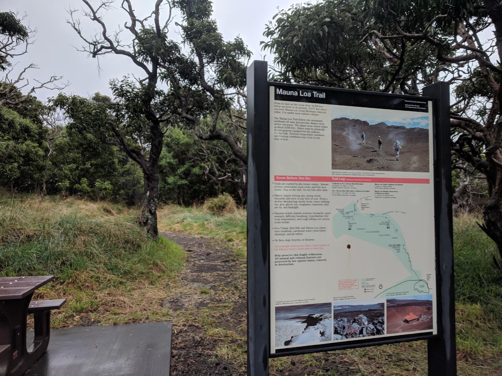
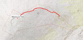
Mauna Loa Trail
The definitive climb up the long mountain.
Before leaving for Hawaii, this trail was the one that I was dreaming about. Sixteen miles of steady climb up the side of a volcano to over 13,000’ in elevation, with the promise of epic views, fantastic geology, and a serious challenge. But upon arrival on the Big Island, I was devastated to learn that the trail was closed along with the rest of Hawaii Volcanoes National Park due to the volcanic instability from 2018 lower Puna eruption.
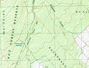
I started trying to find a way to do the Ainapo Trail instead (at least up to the park boundary), and tried to navigate the bureaucracy of the Kapapala Ranch, the private landowner that controls access to that trail. Contrary to the stated protocols on the ranch’s and Hawaii State Government’s websites, the ranch never answered their phone to provide the requisite access codes for the locked gates. Fortunately, to the delight of everyone, the National Park reopened – at first only the main central park, but shortly after the backcountry trails as well. I started planning my attempt.
I stopped by the backcountry permit office in the National Park to ask about the route and see if there was a place to record my plans. For day-only use, there are no permits required (though if you wish to stay at one of the 3 high-altitude cabins, you’ll need a permit); and there is no registry for hikers. All you need is the usual National Park entry fee. The backcountry office employee all but scolded me away, suggesting how dangerous, improbable and difficult running the trail in a day would be. He said he knew of only one other person who had done it. (In fact, the national park’s own website hosts a trip report from Gerard Dean, who did it in 2013 and claims the FKT for the full route to the summit.)
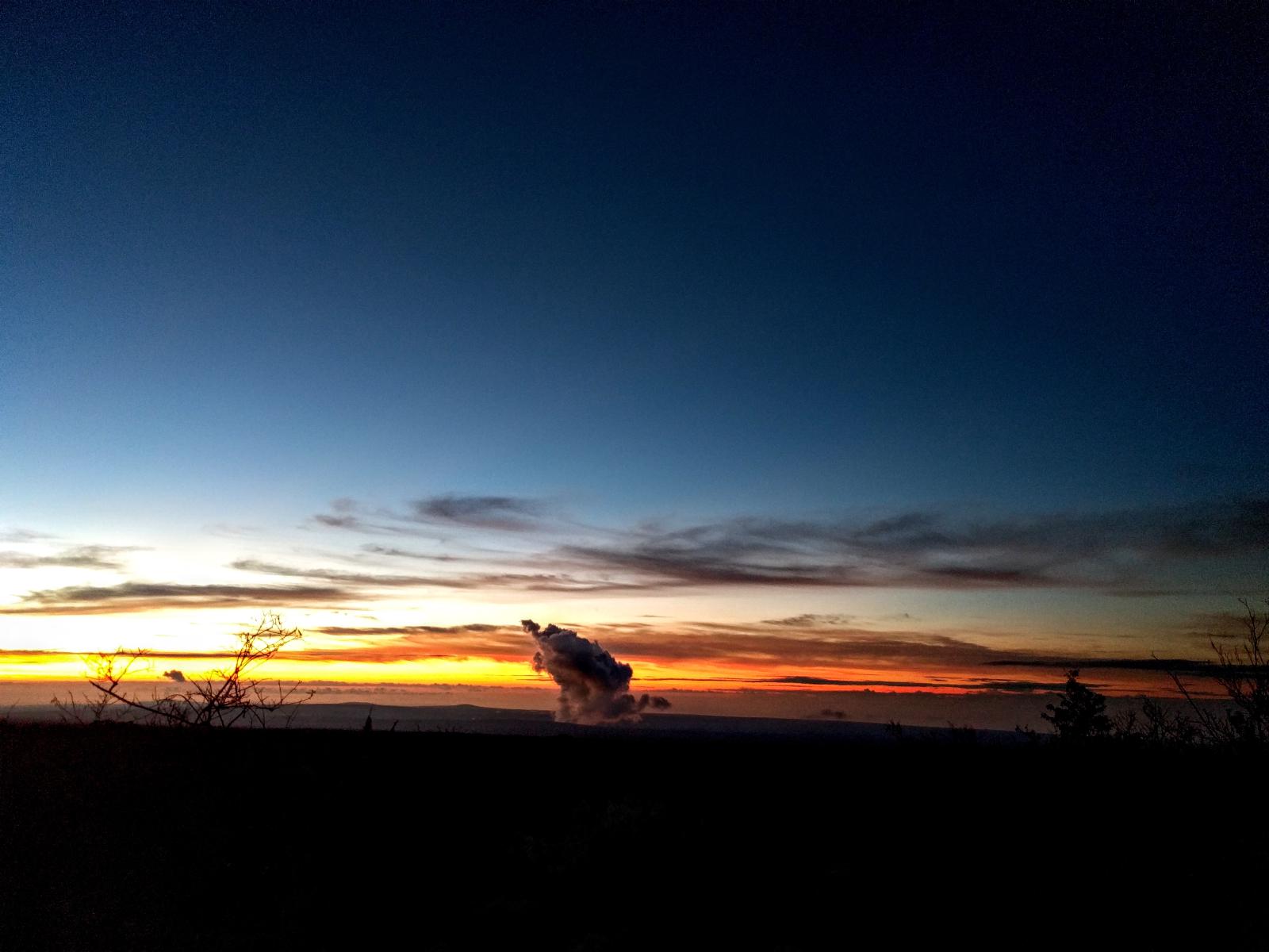
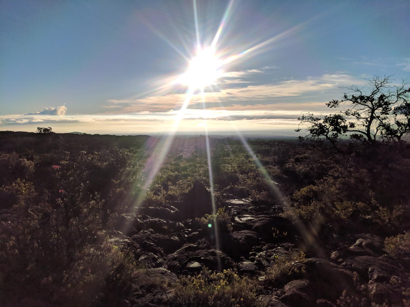
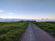
We got started well before dawn, targeting a first-light start. The sun was just peaking over the horizon behind Kiluea’s steam plume when we started up the trail. Goals for the day, in order of priority: (1) a safe trip, (2) reach the caldera, and (3) summit.
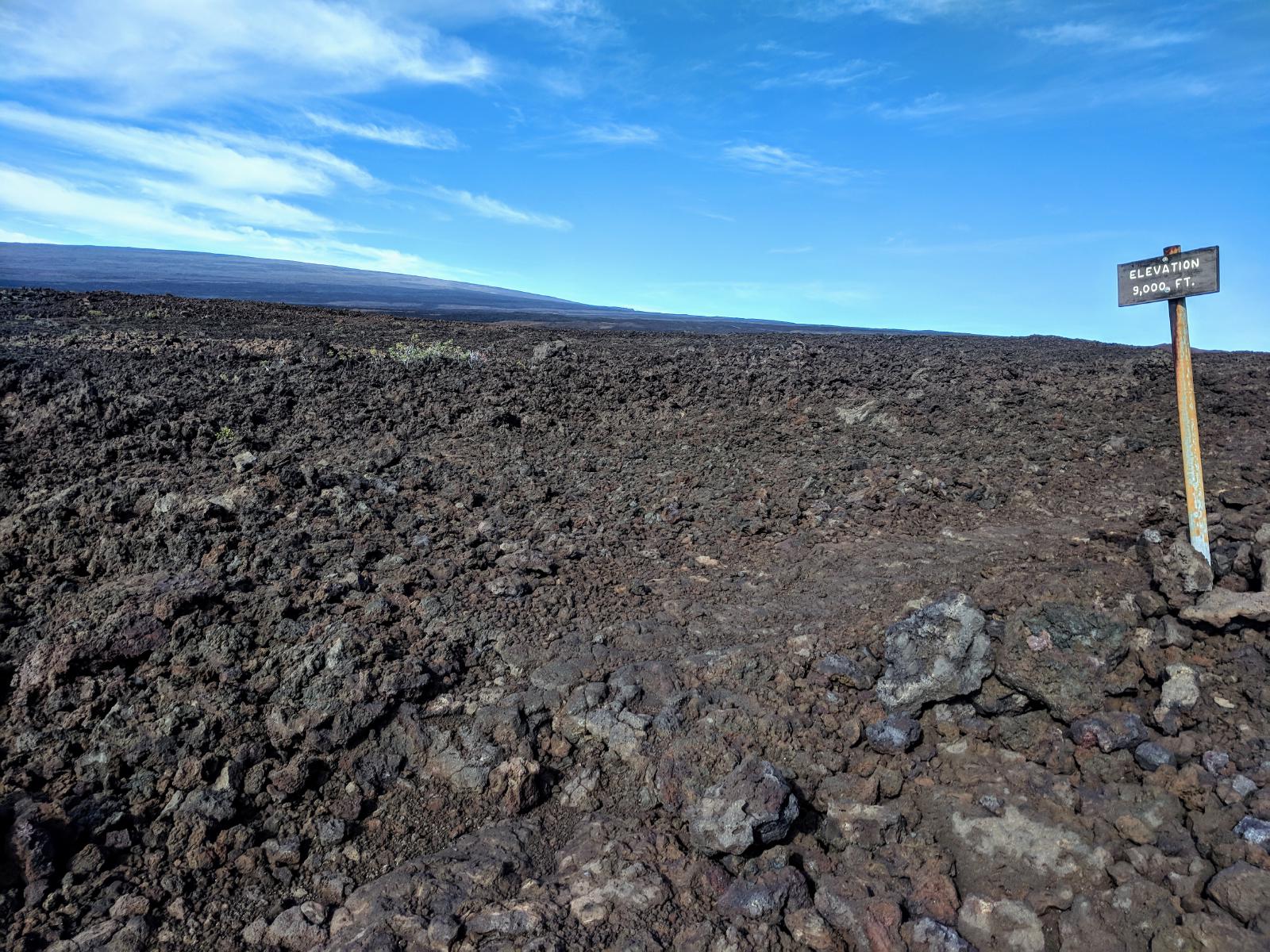
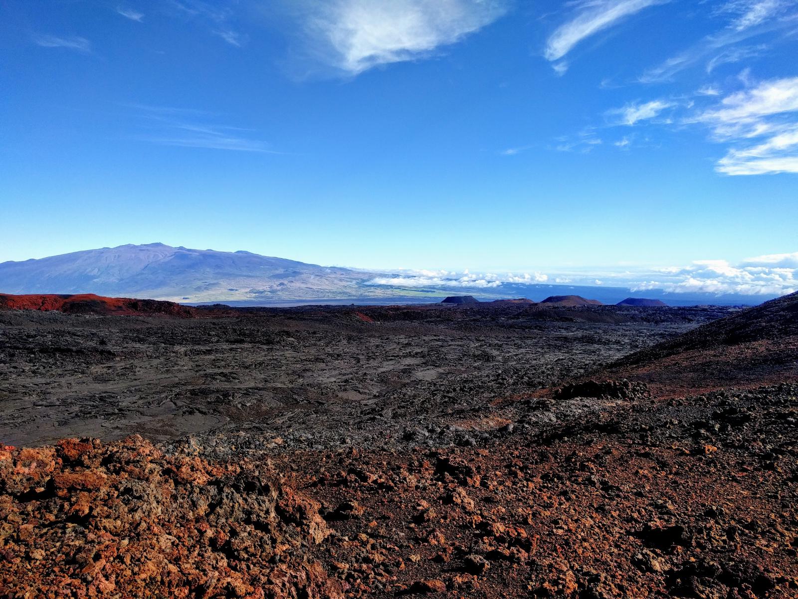
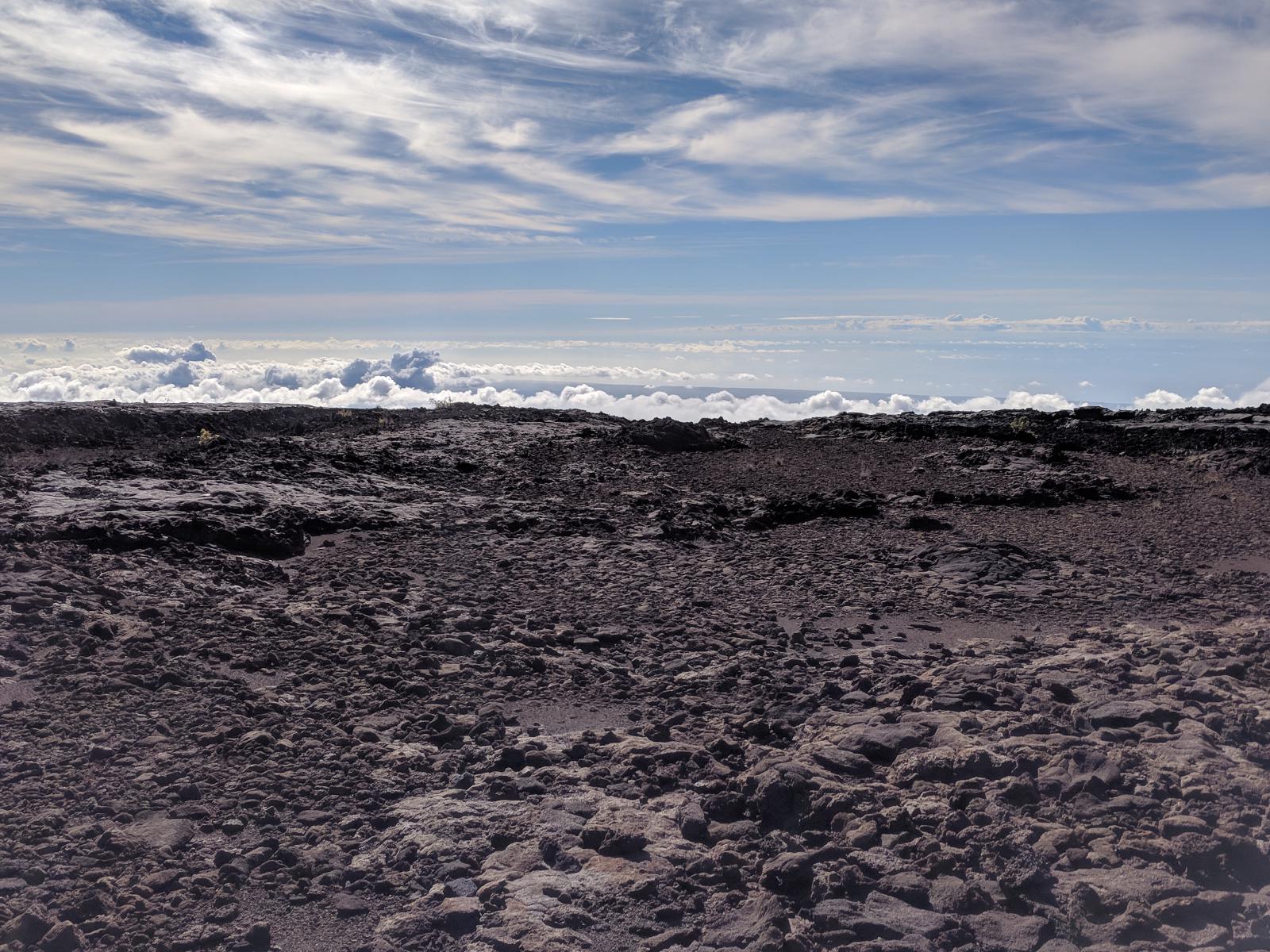
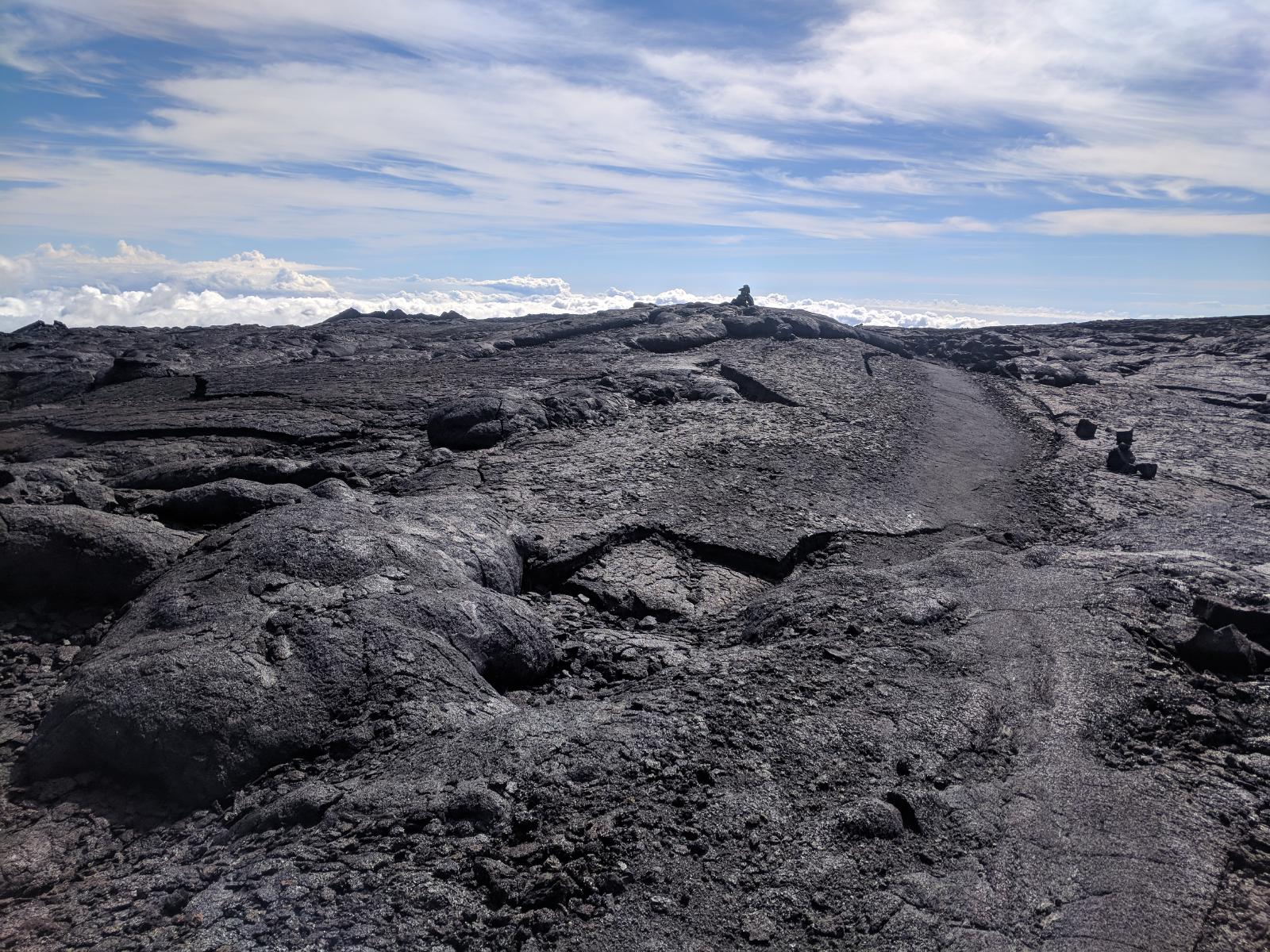
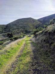
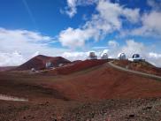
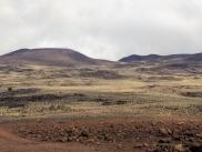
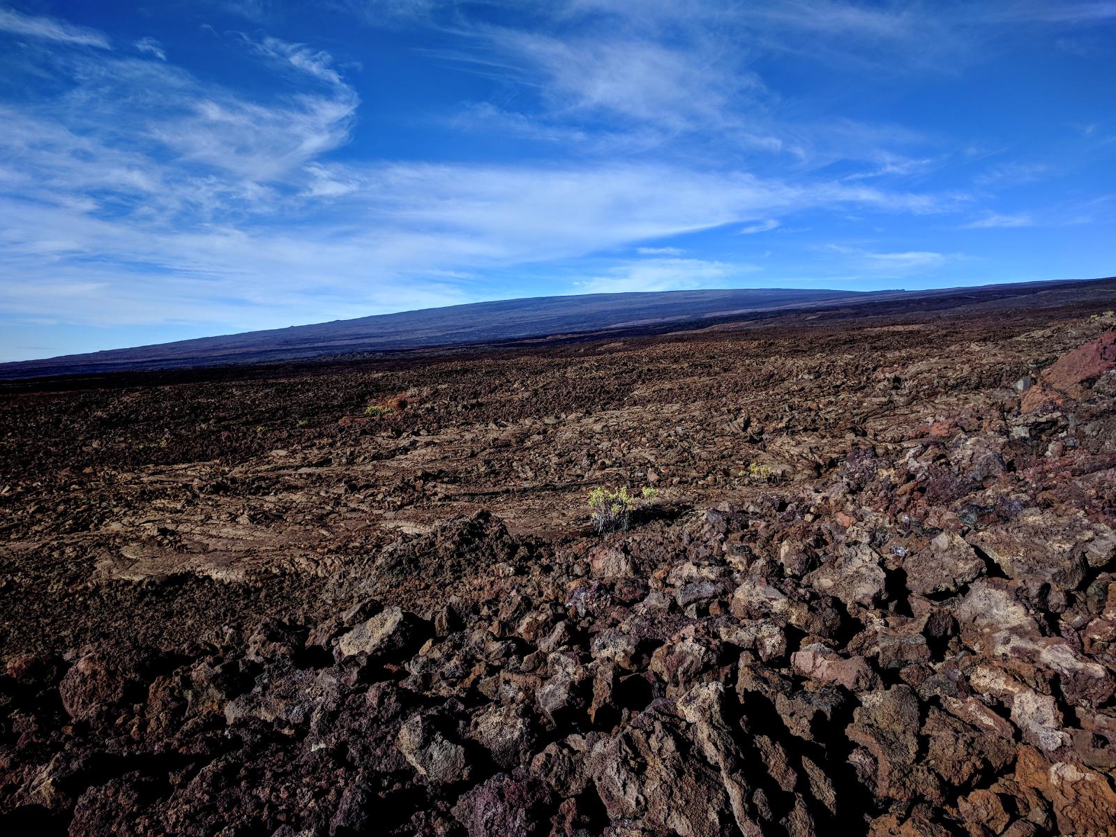
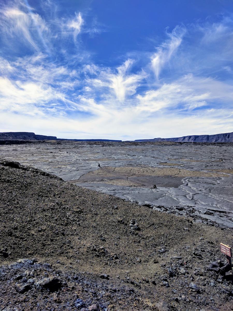
The route is indeed epic; and bears testament to the mountain’s name – Mauna Loa translates to “long mountain”. The shield volcano’s shallow aspect makes for a long climb. The Mauna Loa trail is the longest of 3 approaches to the summit (the Ainapo Trail and Mauna Loa Observatory Trail being the others), but also the most popular. The path steadily and nearly monotonically gains almost 6500’ over the 16 miles to the caldera, always with a mild grade. I found it to be a rather difficult grade for running – a steady enough and steep enough climb that I couldn’t run continuously, but shallow enough that I was never fully comfortable at a walking pace. I settled into a rhythm of light jogging punctuated by speed walking.
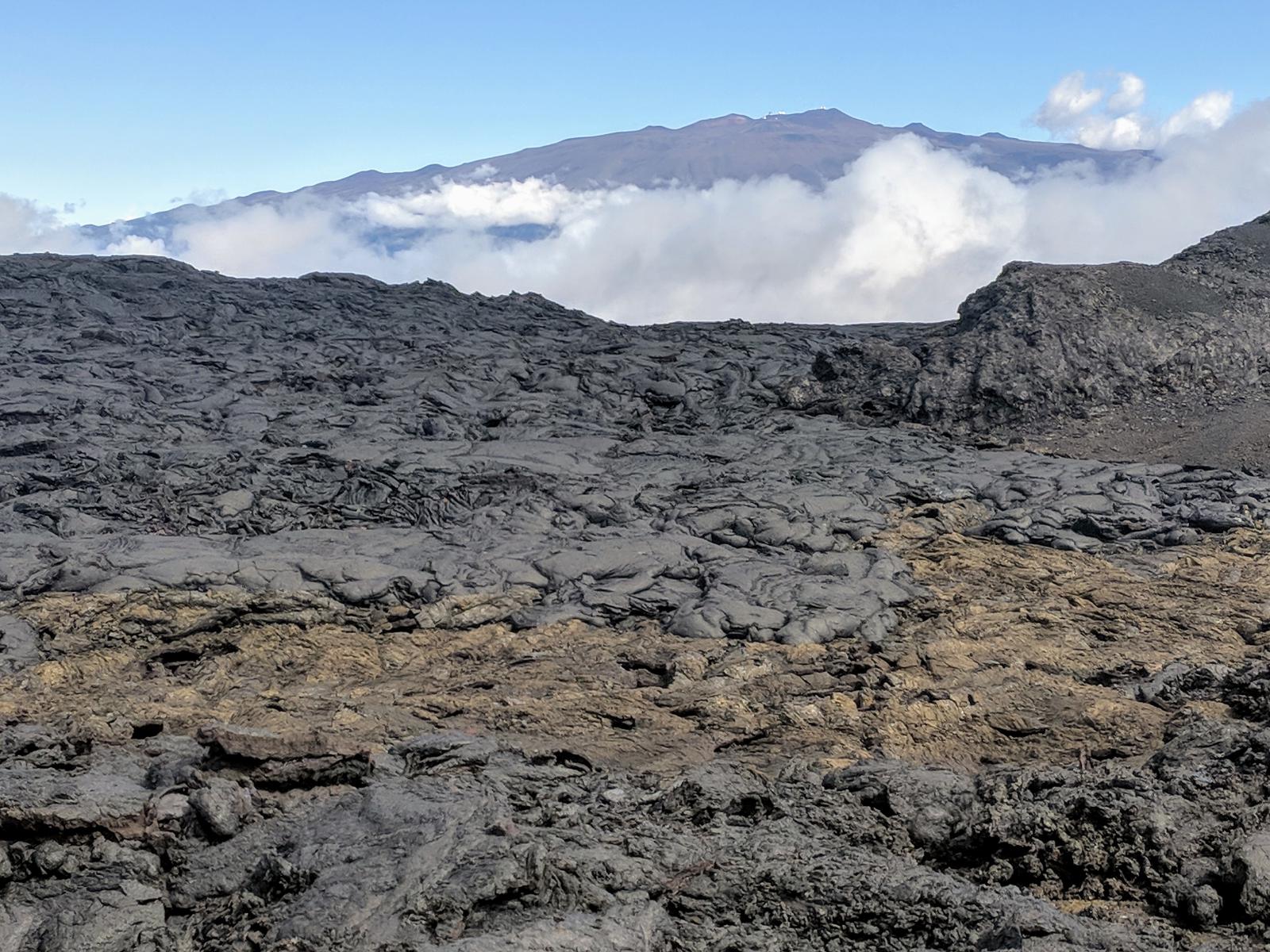
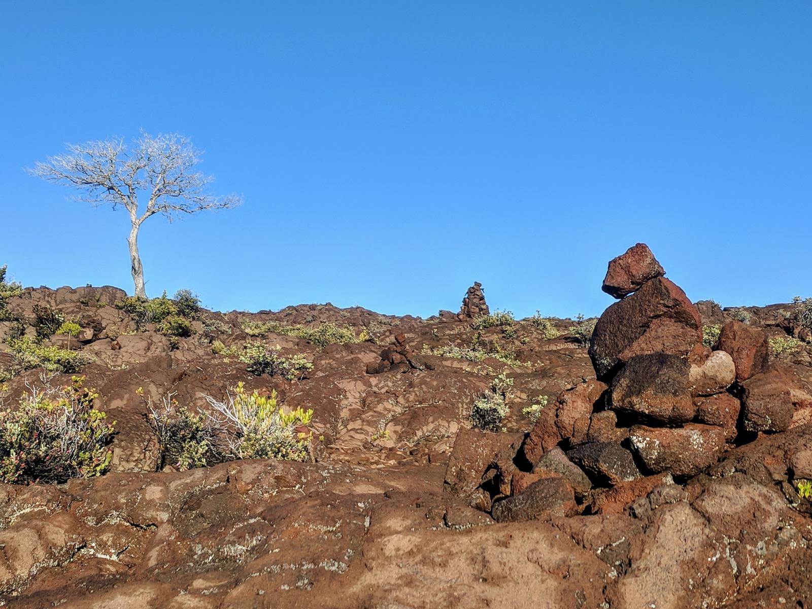
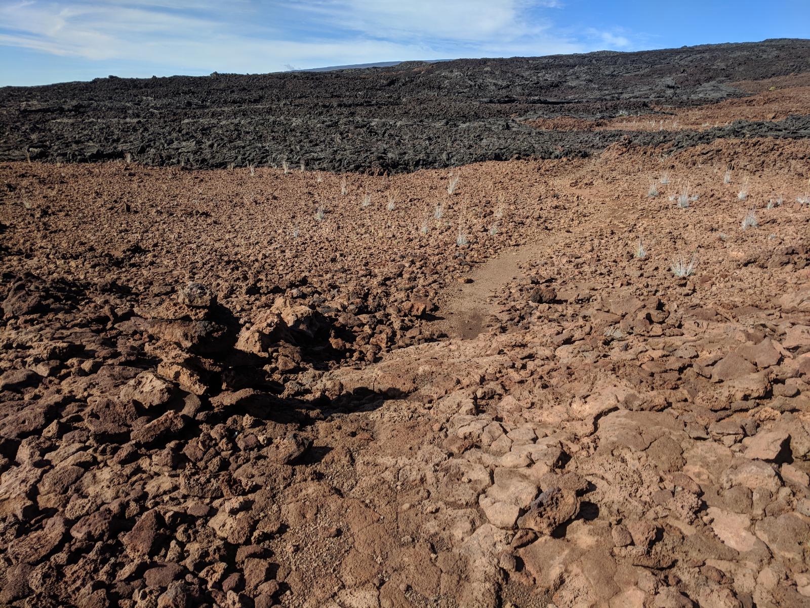
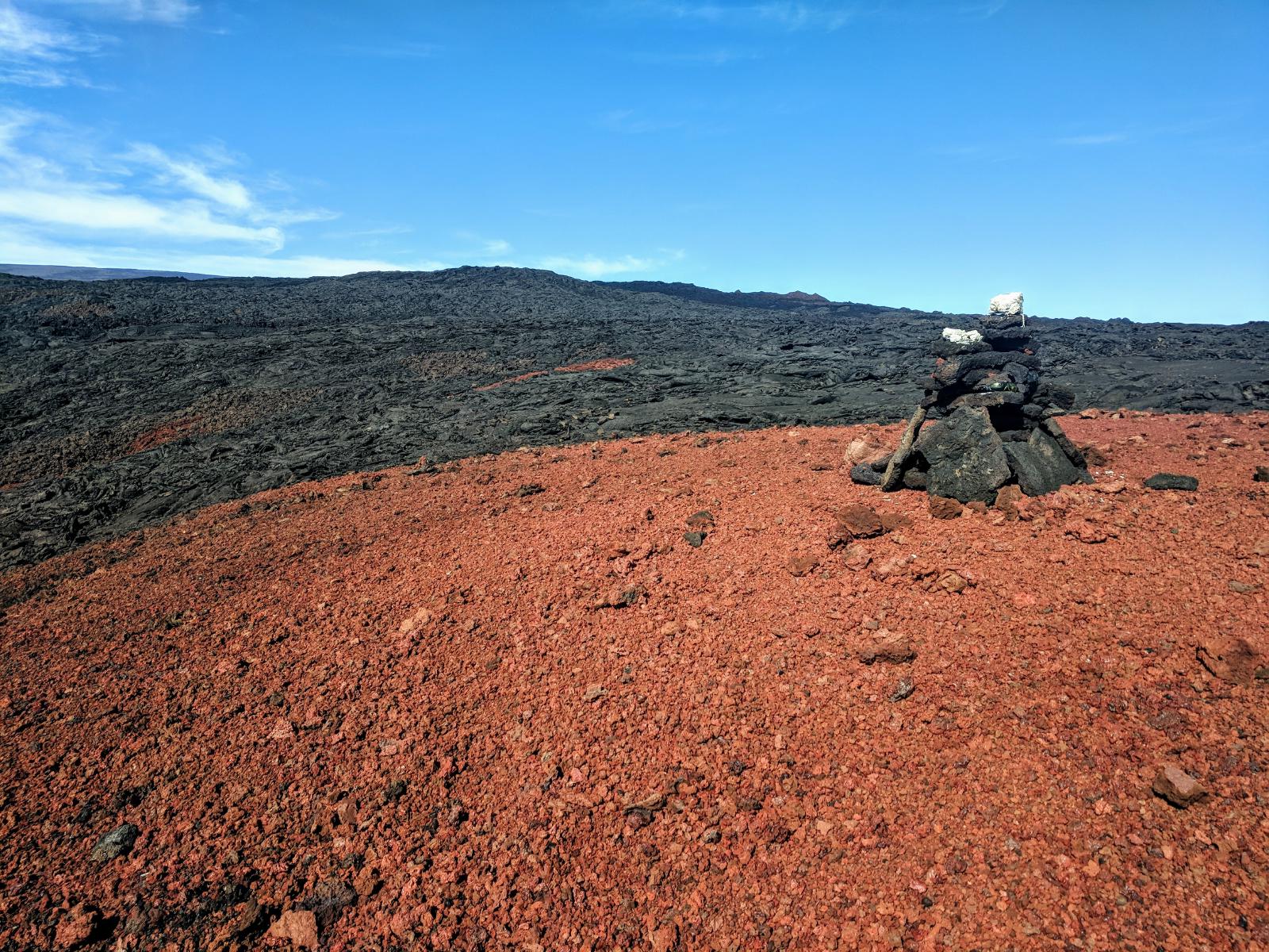
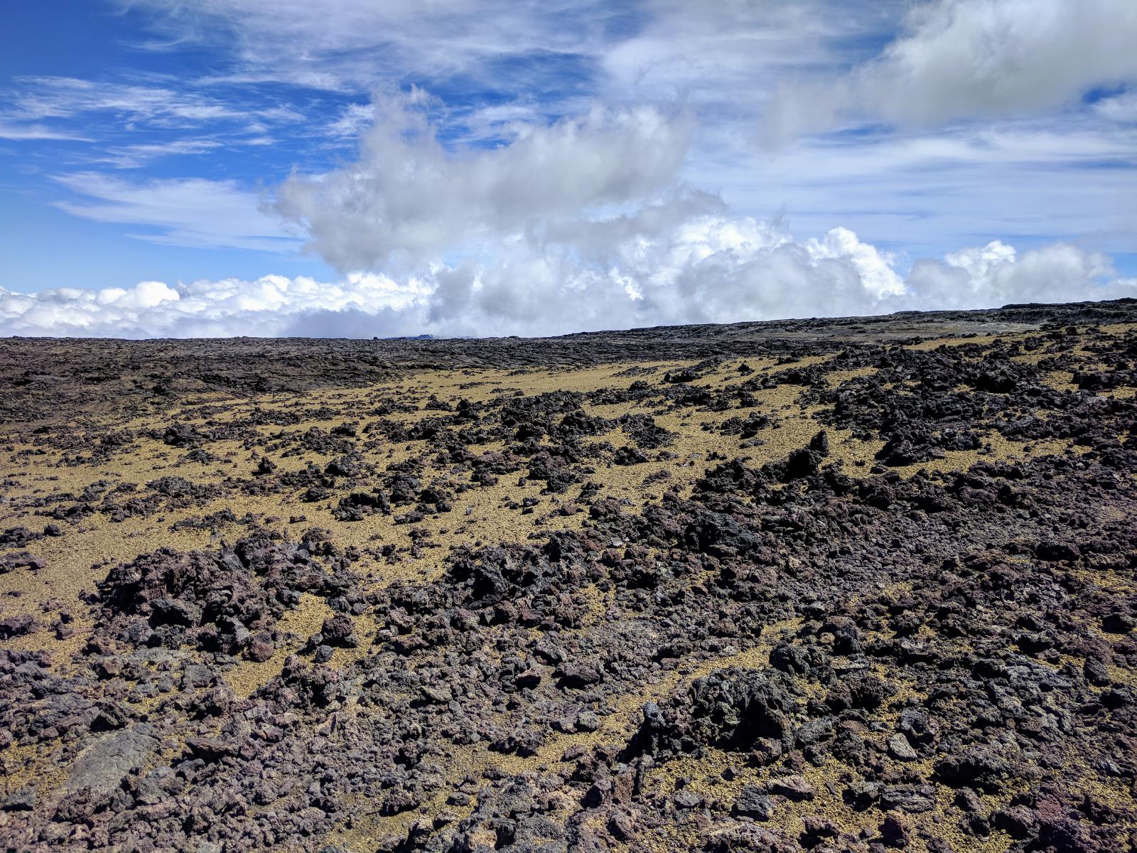
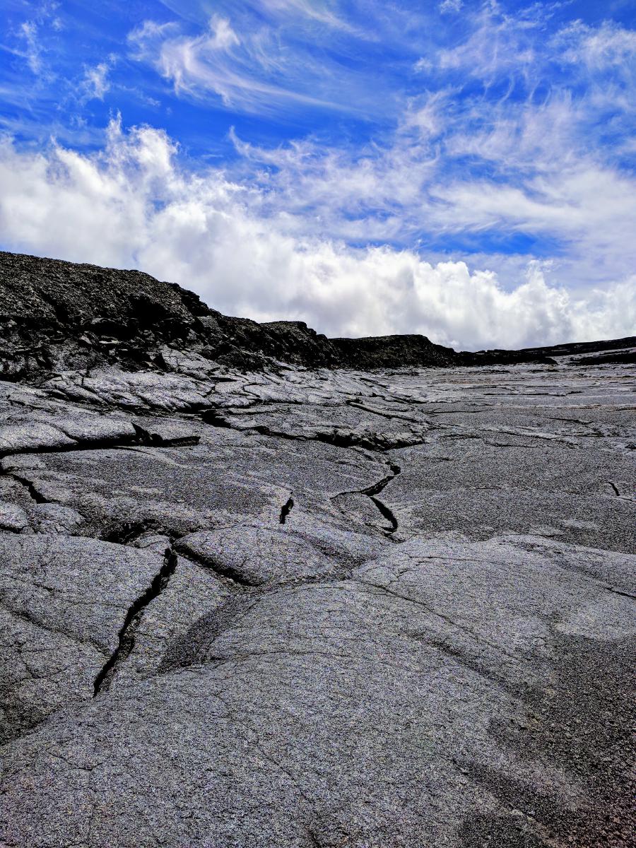
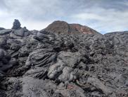
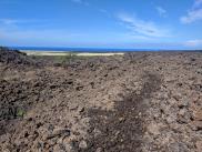
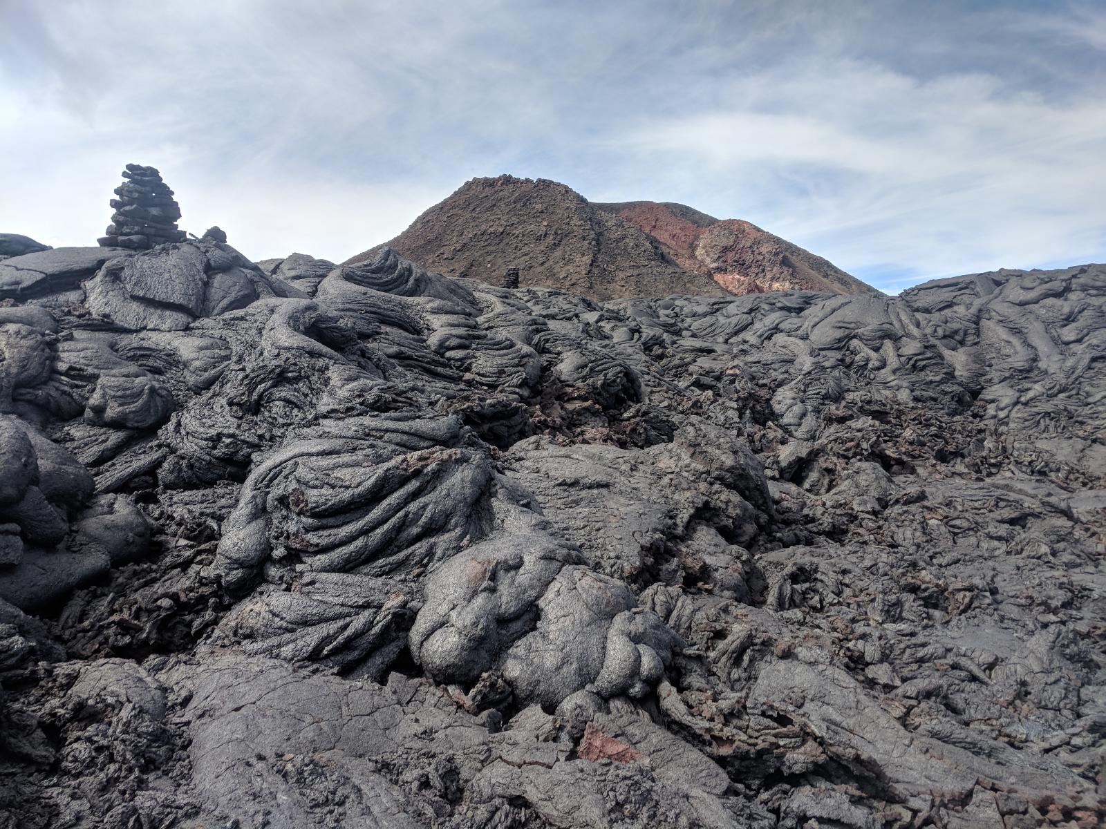
The surface is almost entirely rough lava (apart from a few sandy sections), but mostly of the smoother pahoehoe variety rather than the chaotic fractals of the a’a’ lava. This made the footing less treacherous, and the ample 4-5’ tall cairns were easier to spot among the smoother surroundings than trails with more a’a’. Still, the uneven ribbing of the tread required constant attention to avoid taking a spill, and slowed the rate of travel.
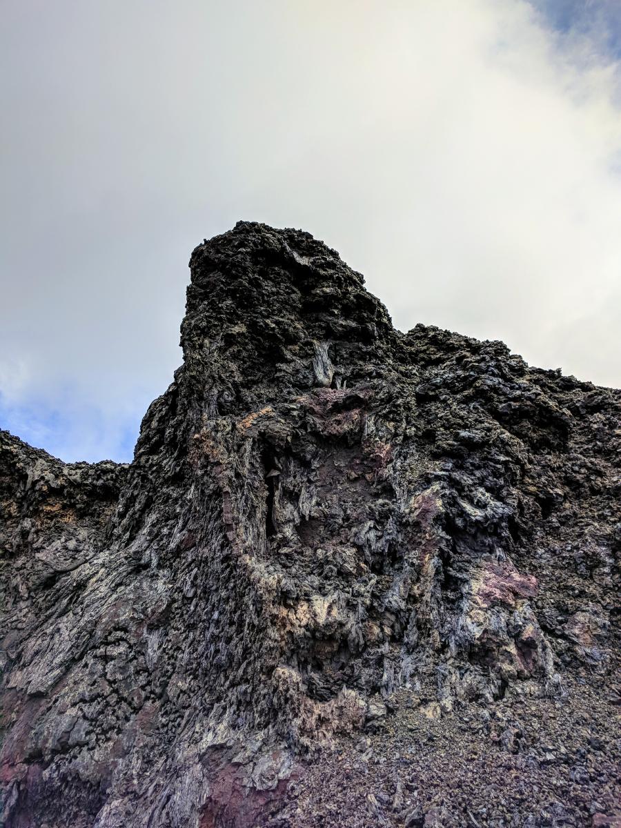
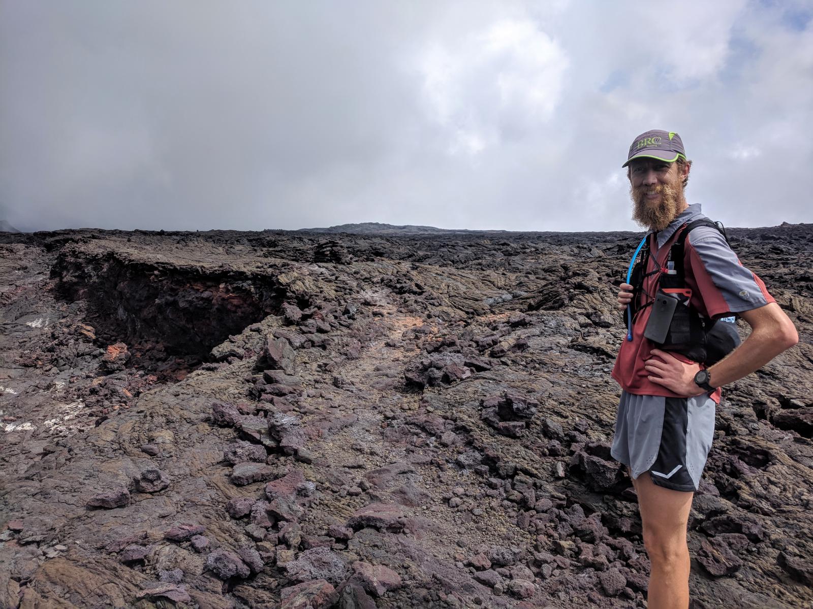
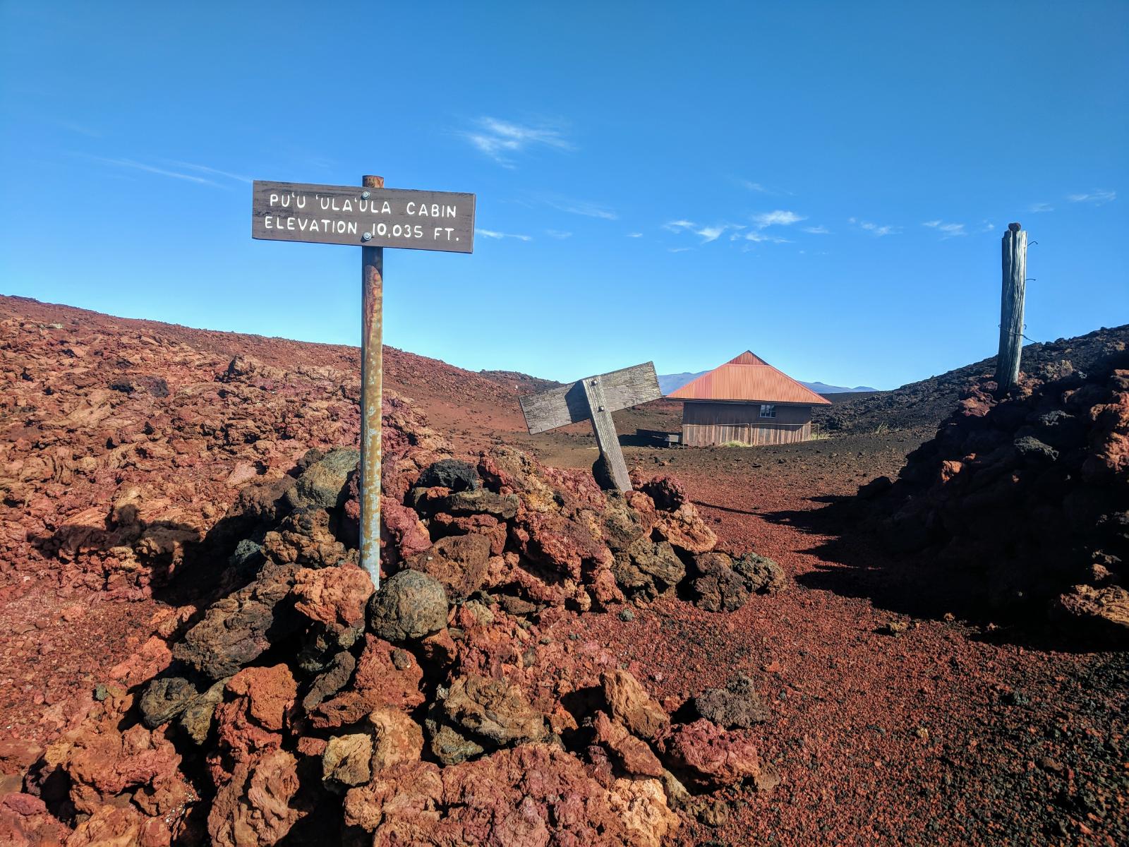
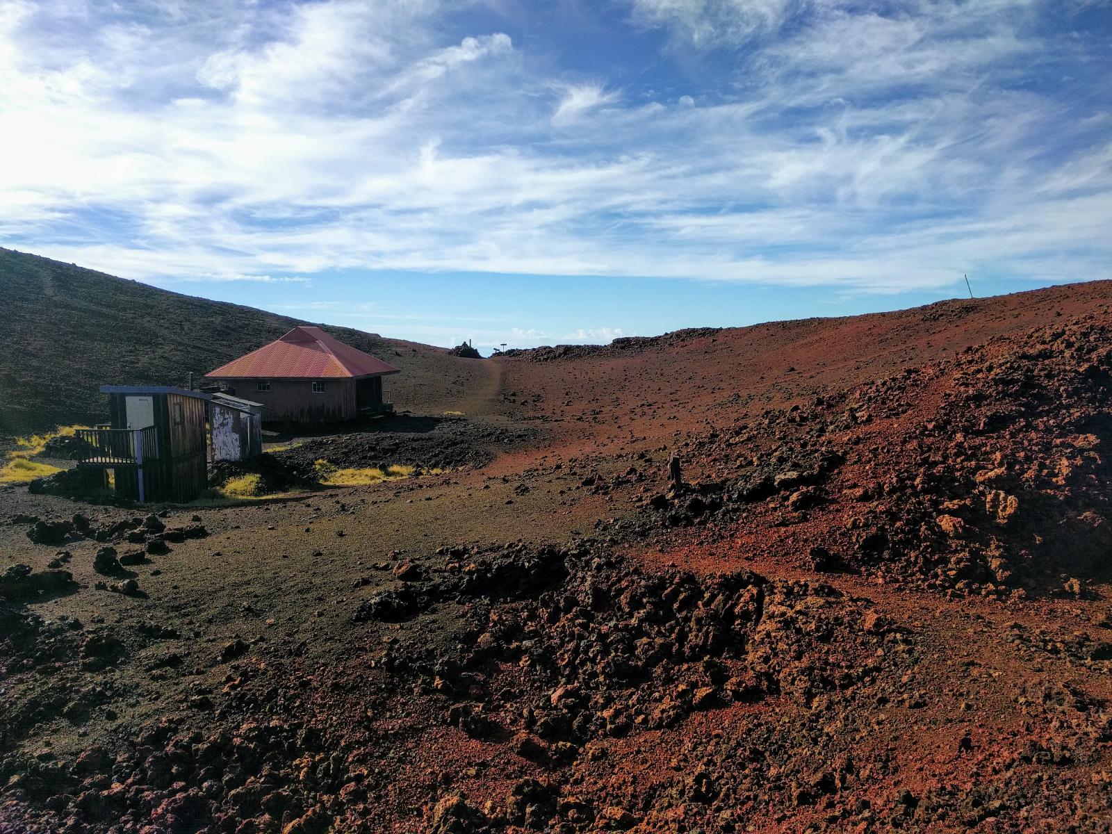
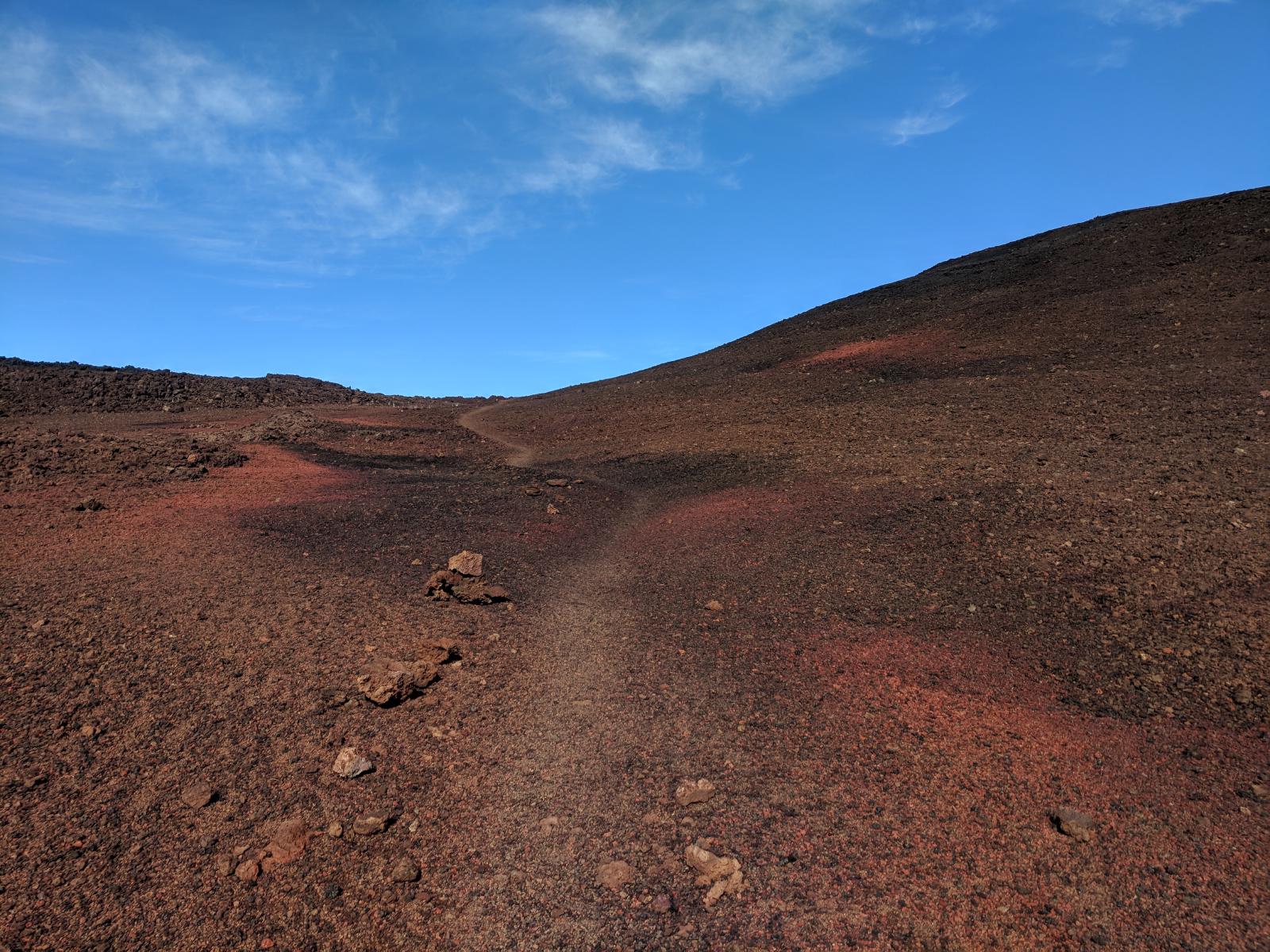
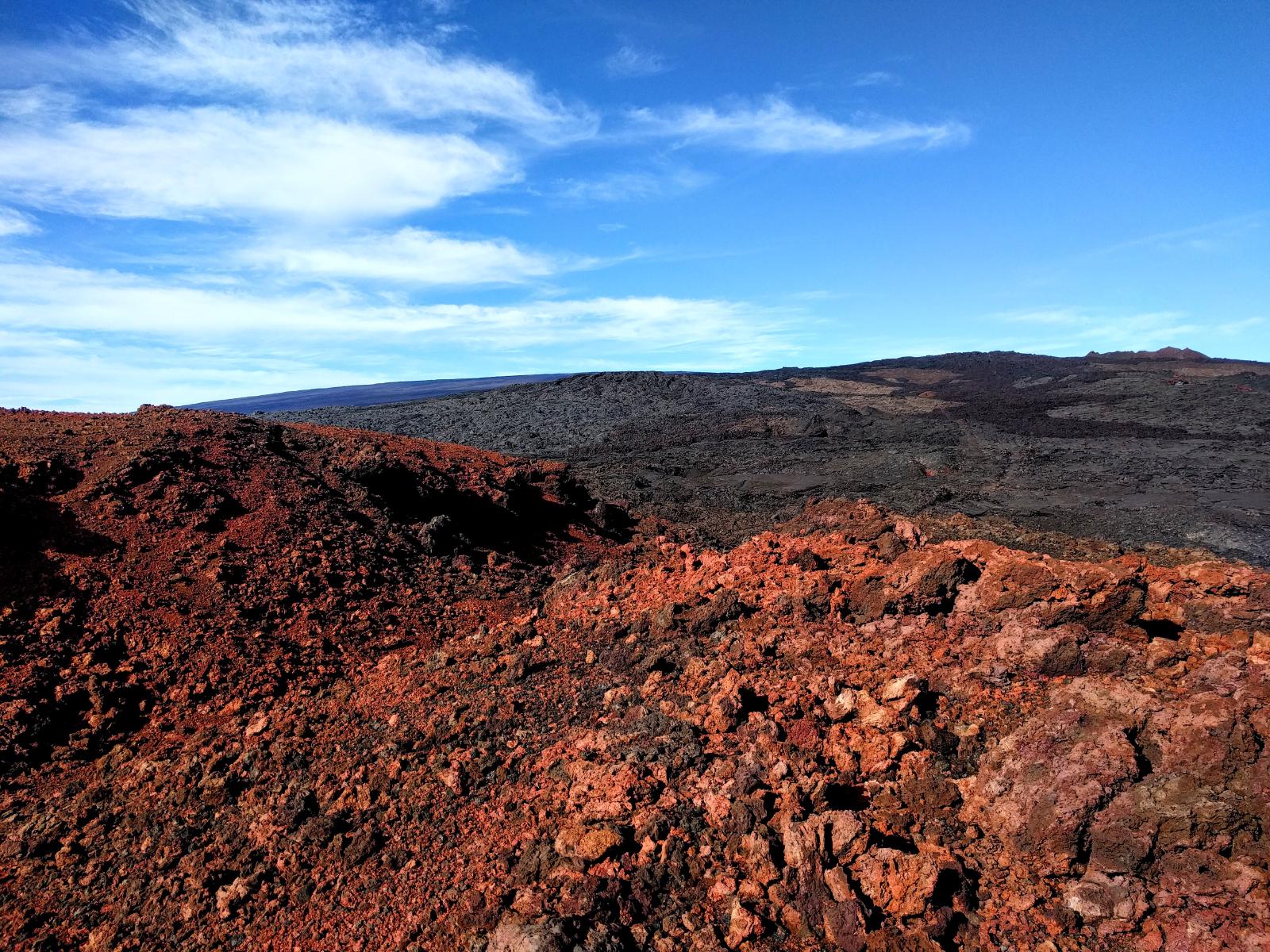
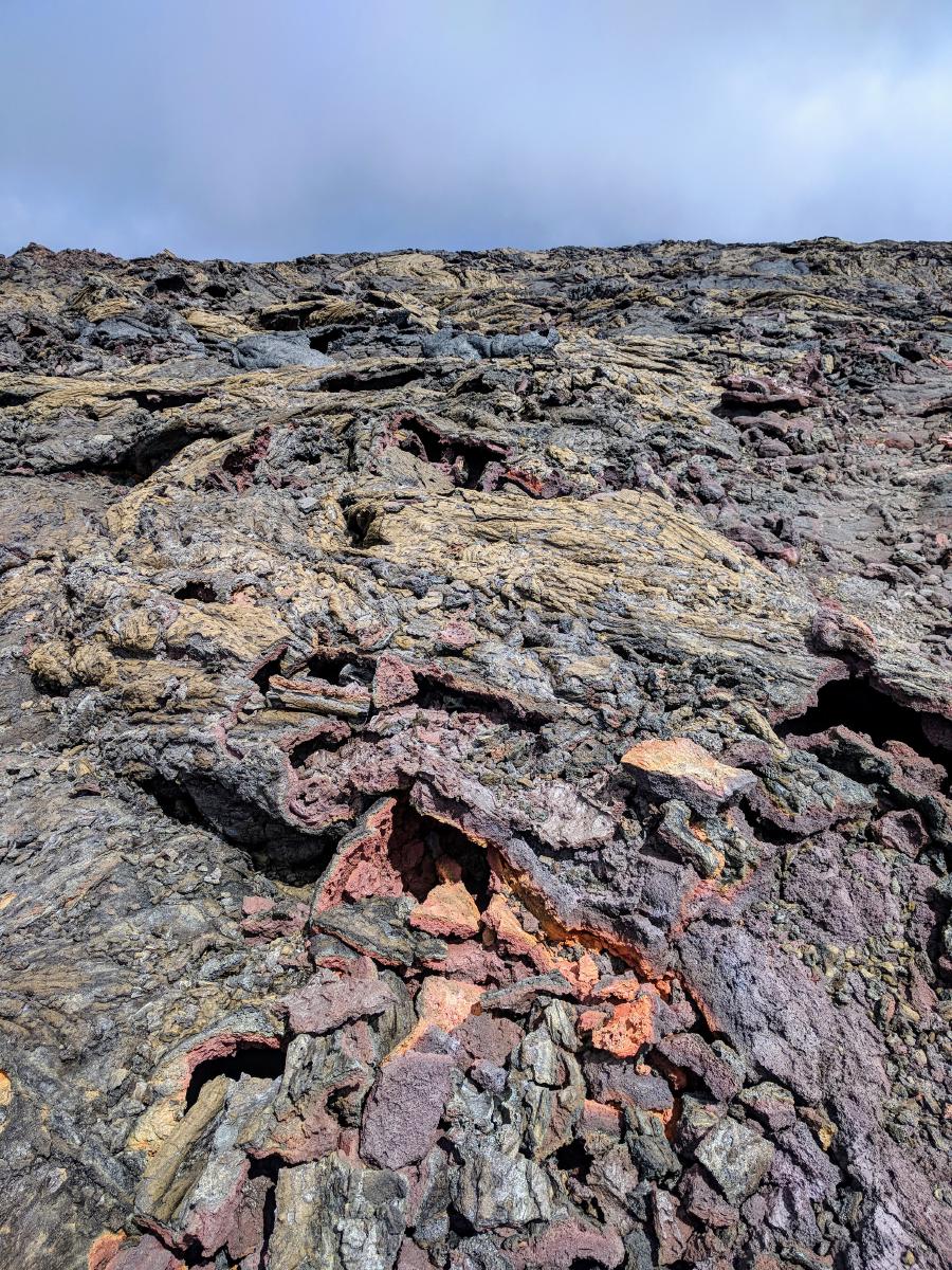
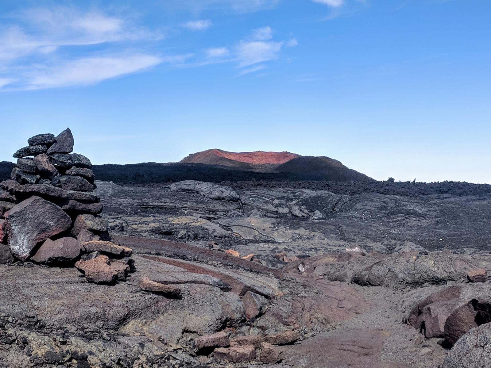
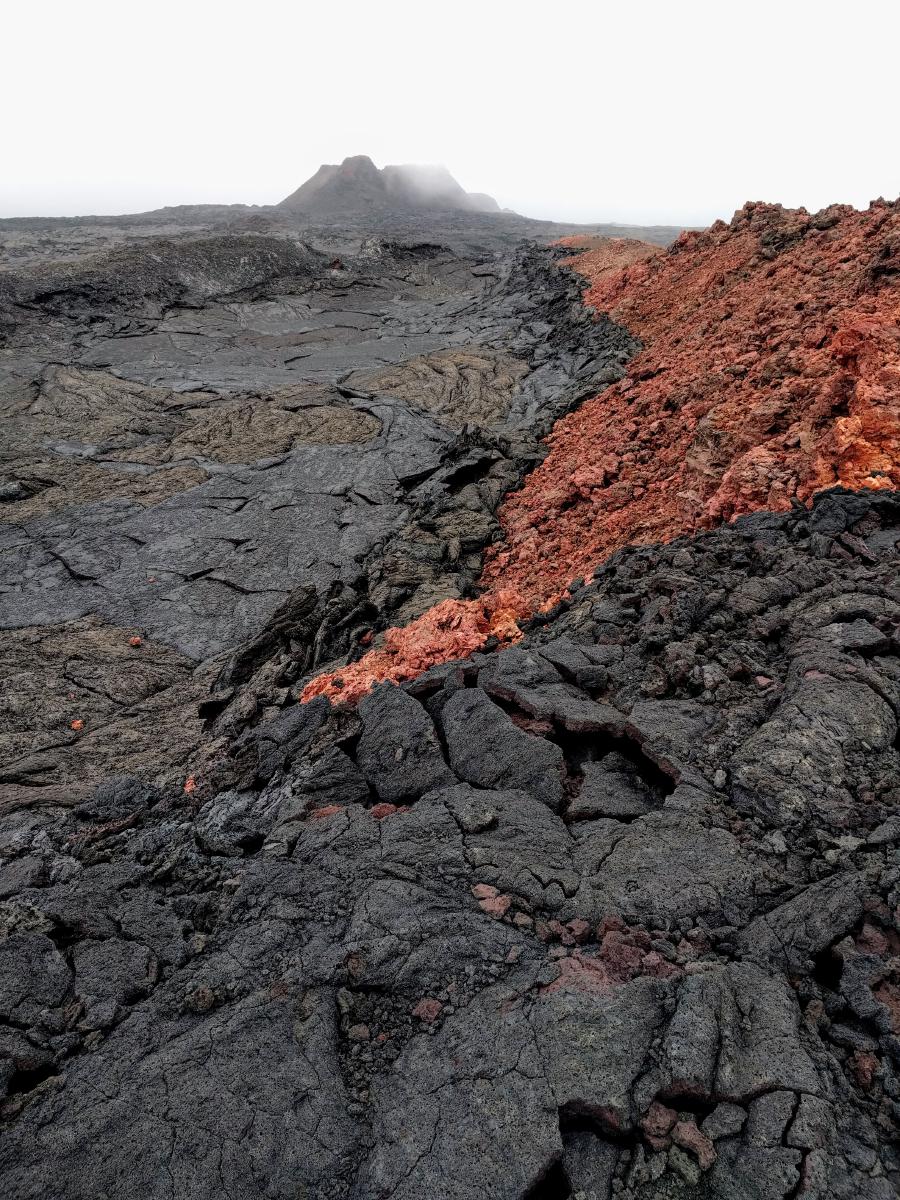
The variety of rock along the trail was staggering. Red hills, steaming vents, smooth fissures lined with “pele’s tears”, shiny rainbow surfaces, monstrous outcroppings, black cindercones, interfaces between varied flows with different textures, colors, and constitutions. I picked up football-sized rocks with shiny multicolored exteriors that felt as light as a tennis ball, and walked on surfaces that crunched like breaking glass under my feet. A short way after the red hill cabin were a pair of seemingly bottomless pits, lined in bright red. Otherworldly.
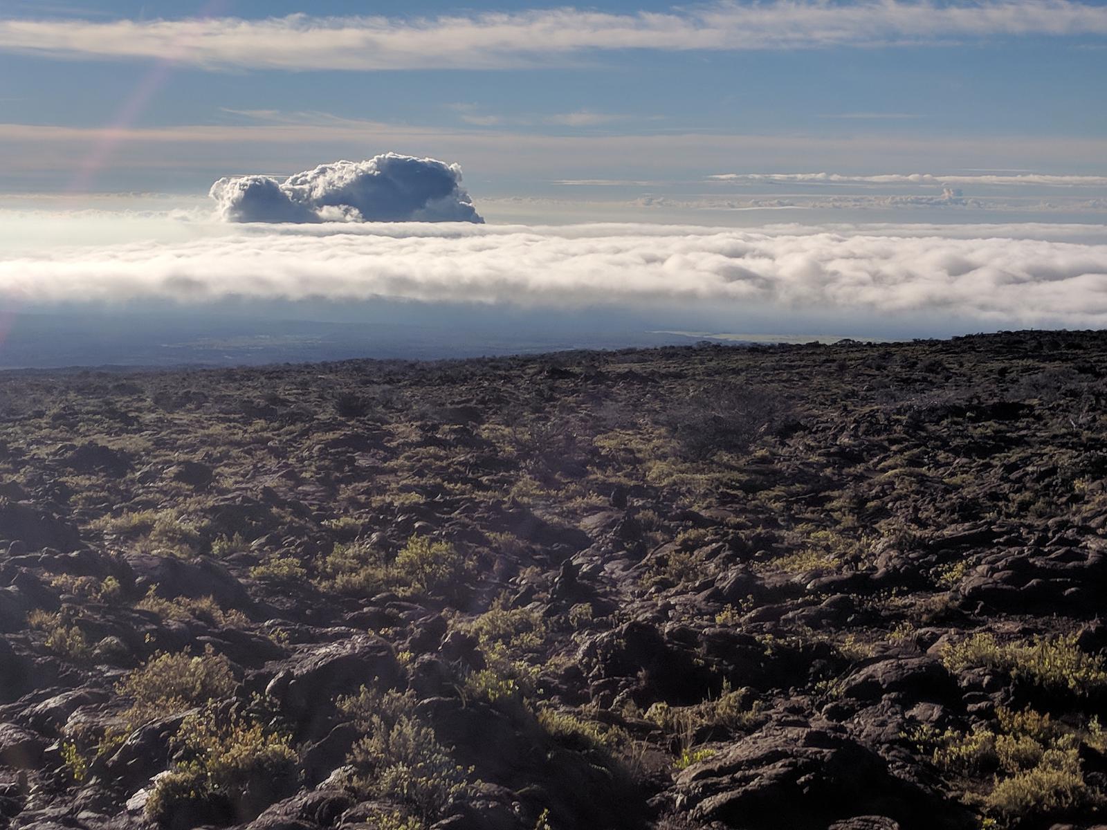
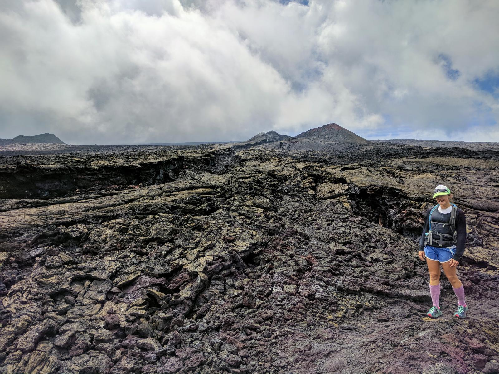
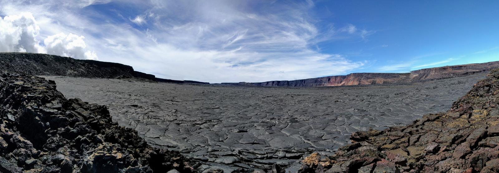
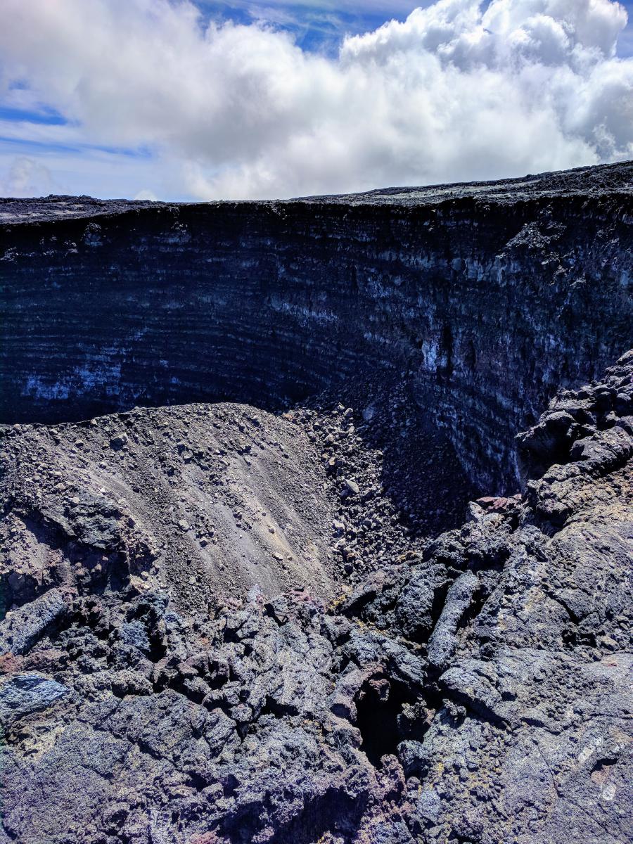
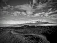
Around 4.5 hours in I reached the caldera, and followed the cairns across its crusted surface to peer down into the Lua Poholo pit and across the large central plain. I’d have loved to continue on to the summit (and figured 1 to 1.5 additional round-trip hours to do so based on my pace), but storm clouds were building to the east, and I worried about the descent. I turned around.
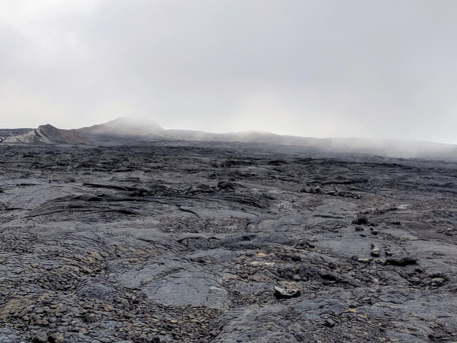
About 2 miles below the Caldera, I met Laura and she turned around as well. She was suffering a bit from some mild altitude symptoms, and on top of that, she didn’t have the benefit of a GPS watch with the route for reference, so we stuck together as the fog built up and visibility dropped. We were still able to see the cairns without difficulty, but could see how a thicker fog could have made navigation quite challenging. Once we’d descended enough that the altitude sickness risk seemed minimized, I pulled ahead again.
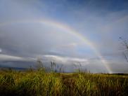
As we descended below 9000’ or so, we started getting some thunder with a couple of close lightning strikes. A challenge with a shield volcano is that altitude decreases slowly. In the Rocky Mountains, it’s easy to shed a couple thousand feet in a hurry. But on Mauna Loa, the gradual slope means that could require many miles of travel. We hurried back to the car as quickly as we could.
Charlie’s notes: This was my favorite run on the island, and definitely the hardest. For anyone with the preparation, fitness, and luck with the weather and volcanic cycles, I highly recommend it. I finished the route in 9:57:26; it could’ve probably beat the FKT had I finished the last two miles to the summit, but I’m glad I turned around when I did given the risk the weather presented us as it was.
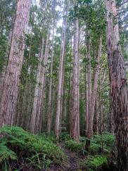
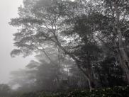
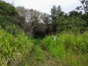
Laura’s notes: A very, very neat landscape (moonscape?) that is worth seeing. I am a plant lover, and remember noting the points along the way where we left plants behind (on the way up) and rejoined them again (on the way down). A truly inhospitible place for most biological life, but a geologist’s dream. This trail broke me (literally, I still have injuries that started on the decent, trying to outrun the lightning strorm), but I still recommend it. Maybe do it over two (or more!) days :)